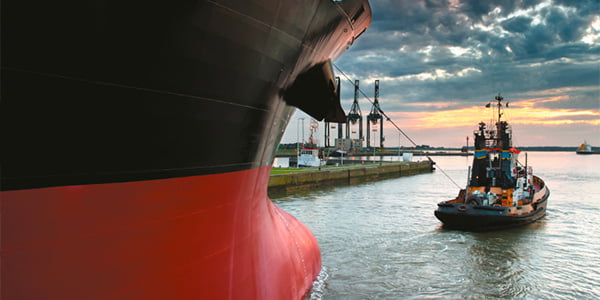
Maritime Monitoring Systems
Real-Time Insights for Enhanced Safety, Efficiency, and Compliance
Get a quote todayDefinition & Benefits
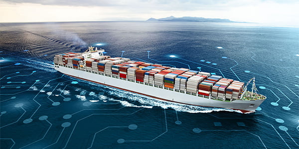
Maritime Monitoring Systems (MMS) leverage satellite-enabled transceivers and onboard sensors to deliver continuous, real-time data on vessel position, performance and environmental conditions. By integrating GPS tracking, engine metrics, fuel consumption and hull-stress monitoring, MMS platforms provide:
- Operational Visibility: Know each vessel’s exact location, speed and heading for optimised routing and collision avoidance.
- Performance Analytics: Monitor engine RPM, fuel burn and equipment health to uncover inefficiencies and drive fuel-saving measures.
- Regulatory Adherence: Automate reporting for fisheries, emissions caps and safety zones with geofence alerts and audit-ready logs.
- Risk Mitigation: Early detection of anomalies—water ingress, excessive vibration or over-temperature (reduces downtime and maintenance costs).
Installation & Integration
Site Survey & Design: Assess antenna placement for unobstructed sky view and minimal RF interference. Map existing network, power feeds and sensor interfaces.
System Configuration: Pair vessel ID and authentication keys; program geofence zones and reporting intervals. Configure onboard dashboards, alarm thresholds and remote-access VPN tunnels.
Hardware Deployment: Install satellite transceiver and GPS antenna; mount data-collection hub near engine room. Connect NMEA, CAN bus and analogue sensor inputs to centralised MMS controller.
Commissioning & Training: Validate signal integrity and end-to-end data flow to the shore-based portal. Train crew and on-shore operations teams on monitoring software and alert management.
Technical Performance
Focusing on robust data collection, advanced analytics, and sustained performance:
- Data Collection
- Vessel position, speed and course via multi-constellation GNSS
- Engine parameters: RPM, torque, fuel flow and temperature
- Structural sensors: bilge-water alarms, hull-stress gauges, vibration monitors
- Environmental inputs: wind speed, water temperature, salinity and pollutant levels
- Vessel position, speed and course via multi-constellation GNSS
- Analytics & Visualization
- Real-time dashboards with KPI trending (fuel per nautical mile, ETA accuracy)
- AI-driven anomaly detection for predictive maintenance
- Automated reports and geofence-triggered alerts to shore notifications
- Real-time dashboards with KPI trending (fuel per nautical mile, ETA accuracy)
- Performance & Reliability
- Satellite uplinks with ≥ 99% availability in commercial shipping lanes
- Adaptive reporting rates: from hourly summaries to minute-interval critical updates
Cost Expectations
The total investment varies depending on factors such as vessel size, number of sensors, integration complexity, and the level of data analytics required.
As a general reference, hardware and installation typically range from $3,000 to over $15,000 per vessel, with ongoing service plans adjusted according to bandwidth needs and reporting capabilities.
To receive an accurate estimate aligned with your operational needs, we recommend requesting a customised quote.
Ensure maximum uptime, compliance, and ROI.
Use Cases
- Commercial Shipping: Fleet-wide route optimisation and ETA accuracy improvements.
- Offshore Energy: Remote asset monitoring for drilling rigs and support vessels.
- Fishing Fleets: Catch-zone enforcement, quota tracking and sustainability compliance.
- Yachts & Superyachts: Security alerts, crew safety monitoring and luxury-service analytics.
- Research Vessels: Environmental data collection for scientific missions.
Regulatory & Compliancce
Fisheries Management: Mandatory reporting in EEZs with secure, encrypted transmissions.
Data Privacy & Security: End-to-end AES-256 encryption and VPN-protected backhaul.
Emissions Tracking: Automated logging for IMO sulphur-cap and MRV regulations.
Safety Zones & Geofencing: Real-time violation alerts for protected areas and traffic separation schemes.
FAQS
What types of data can an MMS collect beyond location?
In addition to GPS position, MMS platforms can ingest engine RPM, fuel flow, vibration levels, bilge-water alarms, hull stress and environmental metrics like water temperature and salinity.
How often does the system report data to shore?
Reporting intervals are configurable—from critical-alert mode at 1-minute intervals to routine summaries hourly or daily—balancing bandwidth usage with operational needs.
What are the maintenance requirements for MMS hardware?
Minimal: annual antenna inspections, periodic firmware updates via VPN, and sensor calibration every 6–12 months to ensure data accuracy and link reliability.
How is vessel data secured during transmission?
All telemetry is sent over encrypted satellite links (AES-256) with VPN tunnelling to shore servers. Access controls and audit logs prevent unauthorised data retrieval.